Everyone wants to be able to explore a new city and find cool new things to do, but they are often intimidated by the big unknown. That’s why location-based app is such a great idea. They allow you to explore your city and find things to do without the stress of having to figure it out all on your own. In this post, We’ll help you to learn about Location-based App Development and Which Technologies are used to making it.
Location Based App Development
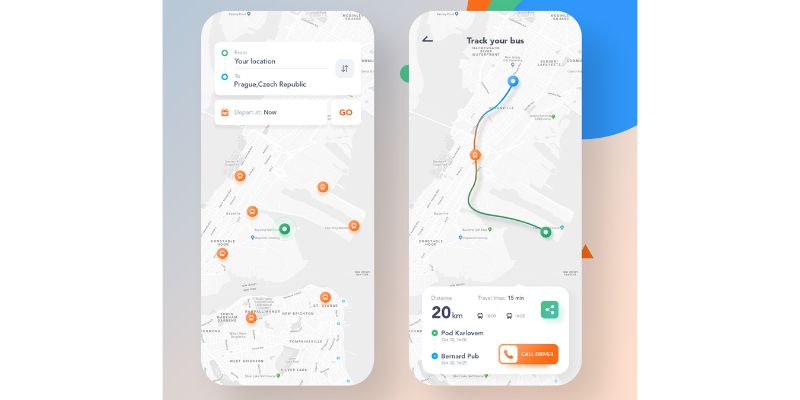
Want to create location-based apps? Let’s dig deeper into it. The mobile-based technology is constantly getting updated every year and also the users can expect more new features to add to their mobile application.
Anyone can build an app easily but not everyone can reach success at all times.
The app with geolocation can have plenty of benefits for the users; it can help to detect the people’s current exact location. The geolocation app has become a backbone for many industries and businesses.
Most app development companies are focusing on creating the user to get the best experience, the features of the geolocation help to provide a robust solution for the users.
How to Make a Location Based Mobile App?
Mobile app development is an increasingly popular field. It’s what’s being taught in colleges, and it’s what’s being asked for on the job market.
When most people think of mobile app development, they think of programming in Swift or Java and using frameworks like Xamarin.
But mobile app development isn’t just about programming. Knowing how to make a location based mobile app development is a valuable
Do Research About Your Idea
If you are going to create an app with geolocation you need to do some general research about your idea, it can help you to know about how it can reach people.
Then you should research the competitors in the market, so you can get some clear thoughts it will make you develop your app better.
Build a Wireframe for Your Geolocation App
After completing the research you get some ideas then you can have a better plan for your creating app.
Next, you need to bring all your thoughts and ideas into reality, you can discuss with your app development team and write those ideas and develop a storyboard.
Create GPS app MVP
Next step you need to create a minimum variable product to estimate your idea at a minimum amount. You can also receive feedback from the users; from this, you can also have some better ideas to create a successful app.
Create a Features Rich Map-Based App
After receiving the user feedback, then you state the second development stage so you can also create or add some other important features to your app.
Benefits of Location based & Geolocation App Features
Location-based app feature is a type of functionality that is common in a lot of apps. The way it works is that the app detects the user’s location and it adjusts the content or the functionality of the app accordingly.
A lot of location-based app features can be used for marketing purposes. Here are some of the benefits of this type of app feature.
Navigation
In this modern world, a lot of new and smart inventions are being created day by day which can be more beneficial for the users.
The need for geolocation apps has been used widely and has made a significant impact on all types of industries.
The navigation apps can help to detect the particular location that they want to reach. It can also help you to find the features likewise direction, route planning, and real-time traffic update.
On-demand App Development
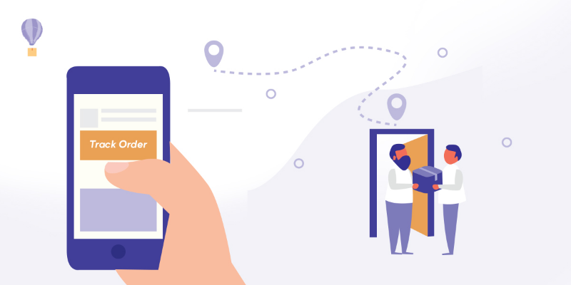
One of the best examples of the on-demand service is undoubtedly the taxi, car booking, as well as food, delivery, or domestic issues assistance.
It can help the user by fulfilling the requirement by the geolocation app; they can easily enjoy the ride service with the help of updated notifications on their mobile device.
Health & Fitness app
This app uses GPS data for tracking fitness activities it can mostly use by the sportsman, run keeper. It can exactly notice every move of the person; this feature can be very popular among the people.
Delivery Service
In this hectic world, most people are busy with their work and they don’t have enough time to go for real-time shopping. But with the help of the geolocation app, they can easily get all kinds of products and things at their doorstep.
The online delivery service is becoming more trending with the help of the location service.
- It can help to track your product.
- You can also get the information and status of the product.
- Then you can also expect the product arrive at the expected time.
GPS Tracking Apps
The GPS tracking app is one of the widely used apps by people for security purposes. It is able to track the exact location of the person which can mainly be used to protect the child from kidnaps.
This GPS tracking app can also help to identify the stolen car, bike, etc.
Travel and Tourism
Not everyone will know the exact route for the non-familiar places; some of the visiting cities also confuse the path.
That’s where location-based travel and tourism apps come into the picture.
With the help of geolocation you can go anywhere in the world you can also get the exact route which can also help to save your money and time.
The geolocation not only gives the one route, usually, but it can also give the possibility of two or more routes for you, based upon your convenience you can pick the right one.
Taxi and Auto Booking Service
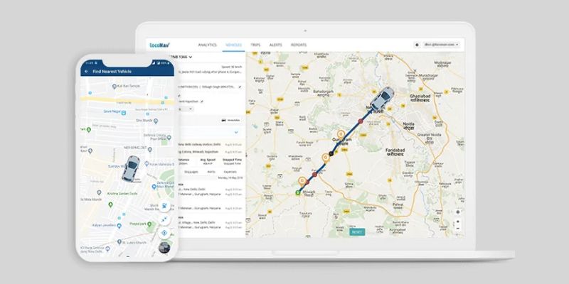
With the help of geolocation, the taxi and auto booking services are well developed.
When you set the exact current location then the taxi will reach the exact time to pick you.
It is one of the more convenient for people; with help of the geolocation, the driver can easily find your exact location.
Social Networking
Another category is the social networking category which includes dating sites. It can be able to connect people based on their business or private interest.
The benefits and the scope of geolocation and other location-based features are increasing demand at a rapid rate.
Geolocation marketing is considered an efficient way to connect the customer and target them according to their location.
Which Technology helps to develop location-based apps?
Another category is the social networking category which includes dating sites. It can be able to connect people based on their business or private interest.
The benefits and the scope of geolocation and other location-based features are increasing demand at a rapid rate.
Geolocation marketing is considered an efficient way to connect the customer and target them according to their location.
Google Maps
It is difficult to discuss ‘location’ without thinking of maps, and the most famous of them is Google Maps. This app helps in detecting and showing a user’s current location with the help of geolocation functions and trackers. Mobile applications such as Uber and Lyft rely on this app for their geolocation services.
Maps
The Google Maps API allows the incorporation of maps to applications. Maps also make sure that you are able to change the display with an embedded panoramic view. The functionality of Maps-
- Maps SDK — Maps SDK allows automatic access to Google servers, response to map actions, and downloads.
- Maps JavaScript API — this distinctive API allows developers to add custom graphic content on their devices and web platforms. The JavaScript API consists of four customizable map categories: satellite, roadmap, terrain, and hybrid.
- Maps Embed API — With this great API, you can add an interactive map to your website with a basic HTTP request. The Maps Embed API differs from the JavaScript API because you can customize it without any Javascript experience.
- Maps Static API— this API allows you to add any Google Maps graphic to your website without dynamic page loading. All you need is to send an HTTP request, which returns a match you can display on your platform.
- Street View Static API — this API gives you access to updated real-life representations of locations. You can embed the API as a thumbnail on your site.
- Maps URLs— this tool generates a cross-platform link that can obtain directions and display panoramic views.
Routes
This API allows access to accurate directions and active routes for given locations on the map. You can also use this tool to monitor real-time traffic updates about route congestion and accidents.
- Directions API — with the Google Maps Direction API, you can get directions as per your preferred mode of transportation. The service also calculates the distance between locations via an HTTP request generated from user inputs.
- Roads API — this tool provides specific data on traveled roads, like speed limits and alternate routes.
- Distance Matrix API — this service calculates the distance between waypoints on a map and the time required to cover it. The Google Distance Matrix API works in conjunction with the Directions API to provide accurate estimates on departure and arrival times.
Places
The Places API allows users to access more than 100 million locations. It also enables users to find places using GPS addresses and phone numbers. The photo location finder users can also take advantage of this API for outdoor and indoor navigation.
- Geocoding API— this service converts long, physical addresses into geographical altitudes and coordinates (latitudes and longitudes). The feature allows users to place a point on the app and get the full address.
- Geolocation API— this effective geolocation tool pings cell towers and uses the information to provide a location within a defined perimeter.
- Time Zone API— this interface enables users to find out the different time zones of locations worldwide. This API provides the time zone and the current time in UTC and day-light savings.
- Places Library— this API enables applications to search for locations and prominent landmarks. The auto-complete features offer relevant suggestions for a better user experience.
Mapbox
It is another map service provider and a close rival to Google Maps. Mapbox partners with Facebook, CNN, AllTrails, Shopify, and other top-notch companies. The functionalities-
- Maps services— with Maps services, developers can work with customizable maps generated from multiple sources. This feature also allows the creation of dynamic and static maps. You can also choose your application’s preferred theme view: light, dark, streets, outdoor, and satellite.
- Navigation services— this tool generates accurate real-time routes for users. Navigation services also include intuitive turn-by-turn navigation and traffic-aware routing.
- Geocoding API— this API provides data on a device’s geolocation
- Mapbox Studio — this service features an independent ecosystem for designers to create and manage geolocation data. The interface allows developers to explore their creativity to come up with fantastic map designs.
TomTom
TomTom is another location-aware tool for the creation of location apps. TTomTom has worked with Microsoft, Michelin, Precisely, Trivago, and other companies around the world.
The functionality of TomTom-
- Maps API — the Map Display API offers access to the Raster and Vector API. You can choose the preferable end-point that is most suitable for your application.
- Routing API — this API is an advanced routing engine for users. The tool generates up-to-date info on routes.
- Search API—this feature works in conjunction with Foursquare to return info about locations based on search queries. The Search API also uses pinpoint geocoding technology for app location-based features.
- Traffic API — this API combines real-time and well-known heavy traffic data for improved location detection.
Technologies Use To Build Location Based Apps
If you are going to build a location-based app, you generally need two-component one is location service another one is a map
GPS Location Based App
Nowadays all modern smartphones are equipped with an inside global positioning system chip.
The GPS can be used to collect information about your current location and the timing which satellites send from space.
Generally, smartphone devices need at least four satellites to easily determine the position at about 60 feet accuracy.
Each satellite determines the ratio signals with their location which is able to collect the information with the exact time.
- The ratio of the GPS signal travels at 300,000km/h.
- The GPS device can able to receive the radio signals with the exact time of the arrival and also it can easily calculate the distance.
Cell Id – Location Tracking Software

While the GPS signals are not connected or unavailable for some time, on that time you can use and get the information from the cell towers.
The mobile network helps to determine whether they are not turned on the internet.
This type of method can work better in many of the cities with a vast amount of cells.
Wi-Fi for Location App Development
The wifi is used to determine the position of the users, so you can identify the exact location of the person. The cell id can also work in the same way but it will cover smaller areas.
There are mainly two ways to determine the location with wifi, the first one is RSSI and another one is used infrequently visited places. The RSSI is able to receive the signal from the phone with a wifi database.
The second one uses the profiles of the same location which can help to identify the position of the users with 2-meter accuracy.
Geofencing
The geofencing can help to identify the person’s particular place very close, whether the user is standing inside or outside the store or just left from that store.
Geofencing can help to determine the exact location point of the person with accuracy. The geofencing can also send some coupons for their users which help to provide the best experience for their users.
Types of Geofencing Triggers
There are three types of geofencing triggers are available such as,
- Static triggers
- Dynamic triggers
- Combined approach triggers
The static triggers help to determine the user’s exact position in a particular place.
The dynamic triggers help to identify the location of the user and allow them to know about the changing data stream.
Geolocation security
Nowadays, the user amount of geolocation is increasing every day. The technology of geolocation can also consider the user’s privacy corners.
Most companies offer more benefits to the users and also they ensure the guarantee of information security.
The information and the data can be highly secured so the users also use this without having any hesitation.
Cost to build Location Based App Development
Cost to build a basic geolocation-based app costs $10,000-$35,000 approximately. Medium complexity apps will cost between $90,000-$160,000. The cost may vary depending on the various factors such as features, platforms, developer’s cost, development hours, etc. To estimate the exact cost you can also use a cost calculator of the app service provided by us. For more info, Contact us now!
In conclusion
Geolocation can act as the backbone for many companies which can also give huge benefits for the users.
With the help of geolocation, people can easily find and reach the location at the exact time.
Location app can be widely used in many ways such as order food, dress and also for booking cars. Now you can get a clear idea about the importance of mobile technology with geolocation.
FAQs
Which is the best location-based app development company in 2023?
Echoinnovate IT is one of the best companies in developing location-based apps. We have 12+ years of work experience.
Our team excels in offering a wide range of services and our products are engineered to improve your business revenue.
Our goal is to serve the client’s satisfaction and user engagement without compromising on quality and time. Feel free to reach us for your app development project.
How does location-based app work?
Location-based apps allow businesses to offer users services near their immediate geographical location. The location details for these apps are transferred through Wi-Fi, cell tower data, and satellite/GPS, you can improve that GPS signal through Wi-Fi or mobile network.
